Top sights in Ha Giang
Dong Van Karst Plateau Geopark
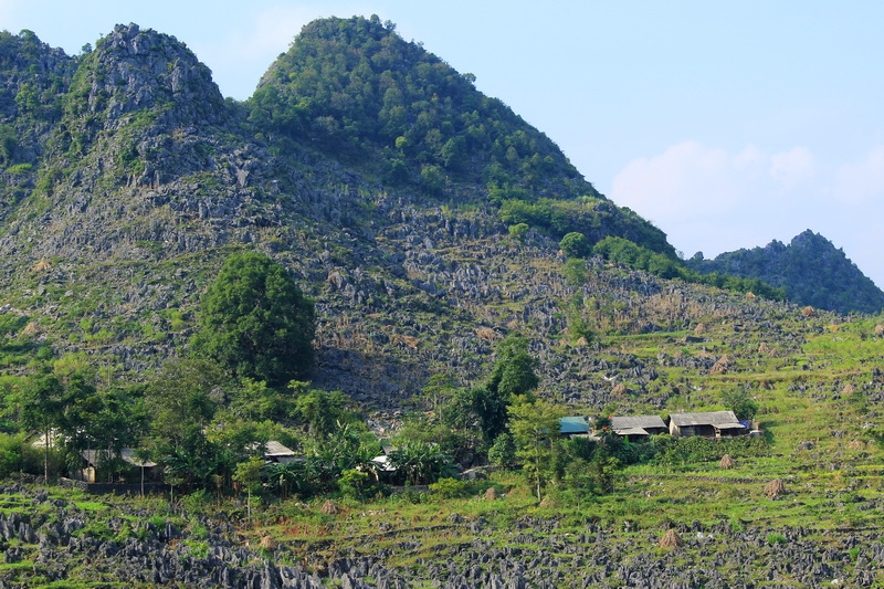
Located in the North of Ha Giang province, Dong Van Karst Plateau Geopark covers an area of over 2,350km square and spreads over 4 districts including Quan Ba, Dong Van, Meo Vac and Yen Minh at the high of 1,400 – 1,600 meters above sea level. This pleataux is known as one of the unique limestone regions in Vietnam, carrying the clear imprints of the evolution of the earth’s crust. There are 80% limestone formations at this plateau. The plateau was recognized as the Global Geopark by UNESCO on 3rd October 2010.
Lung Cu Flag Point
Lung Cu Flag Point is the mark point of the Northern of Vietnam. The journey to Lung Cu flag tower offers you scenic landscapes on both sides of the road with beautiful mountain backgrounds and local villages of Hmong, Lo Lo. Walk up to its top points of 1,700 meters high, you can extend the view to the horizon of local villages, the standing out rice terraces. For Vietnamese, reaching this point of the country – an emblem of Vietnam’s territorial sovereignty, one will feel its sacredness and one’s love to the country.
Lolo Chai village under the Flag Tower
Dong Van Old Quarter
Located in Dong Van District, this 100-year-old quarter is now one of the best tourist attractions in Ha Giang. It has many ancient structures with unique architecture, winding streets, and intact contours.
Vuong Family’s House
It is a special old house and beautiful architecture of the king of Hmong – Vuong Chi Sinh and his family. The architecture of this house is the harmonical combination of Chinese and Hmong’s styles.
Pao’s house
The house is home to typical upland architecture, ethnic minority people’s simple way of life and humble locals.
Khau Vai Love Market
It is a local market in Khau Vai commune, Meo Vac District. It is a unique event in the culture of the locals in particular and Vietnam in general. It is the traditional fair of trible minorities including Hmong, Dao, Tay, Nung. At the market, the local people not only buy/ sell colorful costumes and handicrafts, they also come to look for real love in their lifetime.
Nho Que River
Located at over 1,500m high above the sea level, it is around 46km long with the upstream stretching more than 5km in the shared border between Vietnam and China and the rest flows through two Vietnam’s provinces are Ha Giang and Cao Bang. Running through the rocks, the stream created a wonderful waterfall in the middle of the valley.
Ma Pi Leng Pass
The pass is well known for its dangerous but wonderful 20km road an altitude of over 1,500m over sea level. Over the passed, there is a path called “Happiness Road” was constructed from 1960 by Hmong people. From the pass, you will see the Nho Que river and the stunning view of mountain ranges. It is considered the king of all passes in Vietnam.
Quan Ba Heaven Gate and Twin Mountain
The Quan Ba Heaven Gate is at a height of 1,500 meters above sea level. From the gate, you will see an impressive captivation of Dong Van Global Geopark, immense valleys of rice terraces, Tam Son town, and many dotted surrounding local villages. You will also see the Twin Mountains (also known as Fairy Mountains) – the special art created to this land by Mother of Nature.
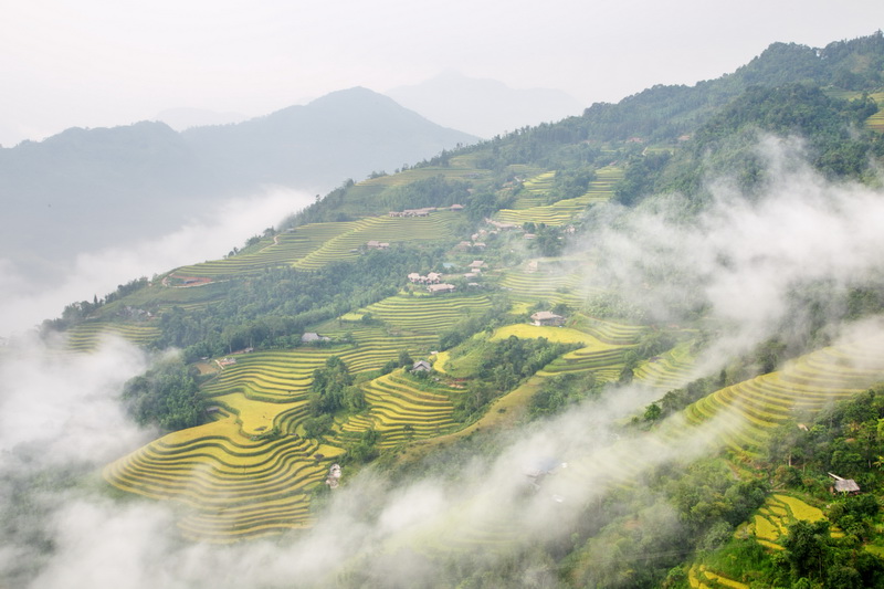
The beautiful rice terraces in Hoang Su Phi
There are two seasons to visit these beautiful places between May and June – the time of falling water into the fields and between September and October – when the rice gets ripe and makes its fullest beauty of golden colors. It is a stunning and impressive beauty for photo and scenery lovers.
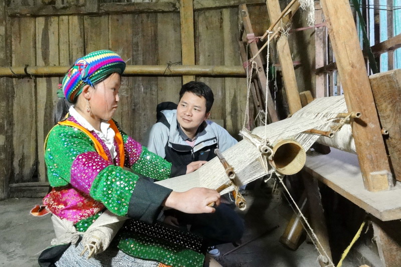
Lung Tam Weaving Craft Village
Coming here you will see the tribal people make weaving crafts in their traditional way and see the colorful products made from Lung Tam flax fabric.